Windward Islands Political Map Islands Lesser Antilles South Leeward Islands — Stock Vector

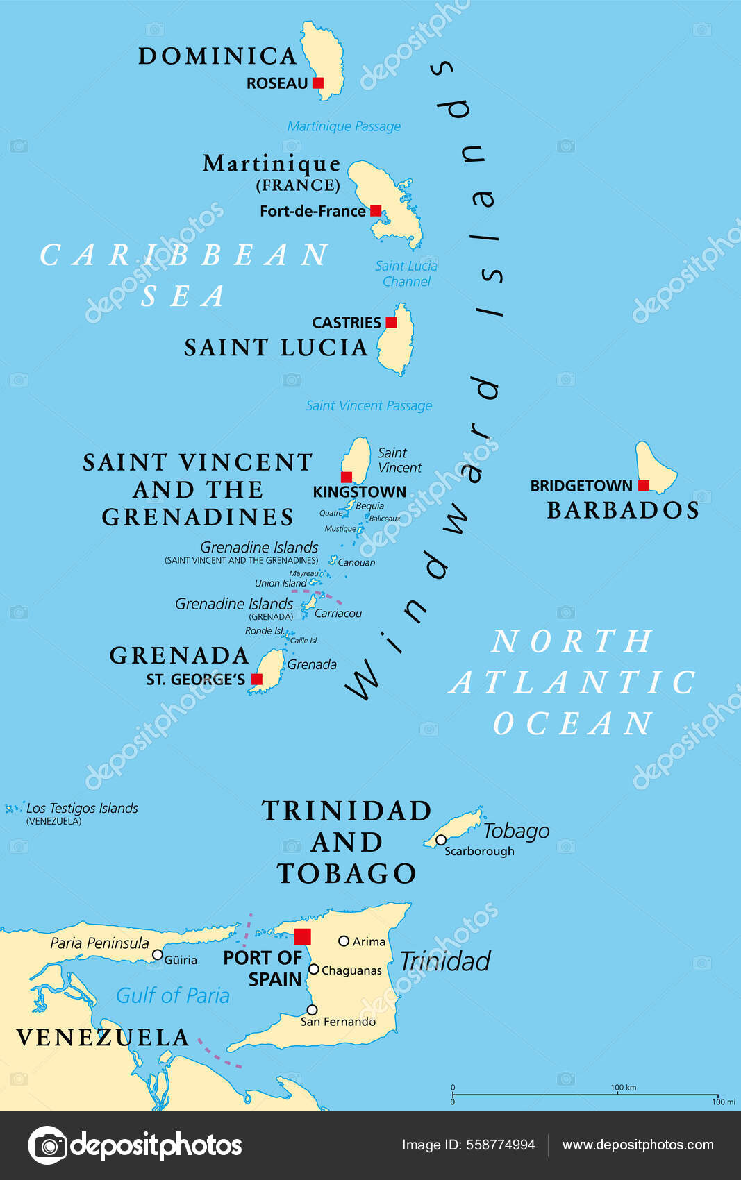
Windward Islands political map. Islands of the Lesser Antilles, south of the Leeward Islands in the Caribbean Sea. From Dominica, Martinique, Saint Lucia, Saint Vincent and the Grenadines, to Grenada. — Vector

Windward Islands political map. Islands of the Lesser Antilles, south of the Leeward Islands in the Caribbean Sea. From Dominica, Martinique, Saint Lucia, Saint Vincent and the Grenadines, to Grenada.

 — Vector by Furian

Same Series:

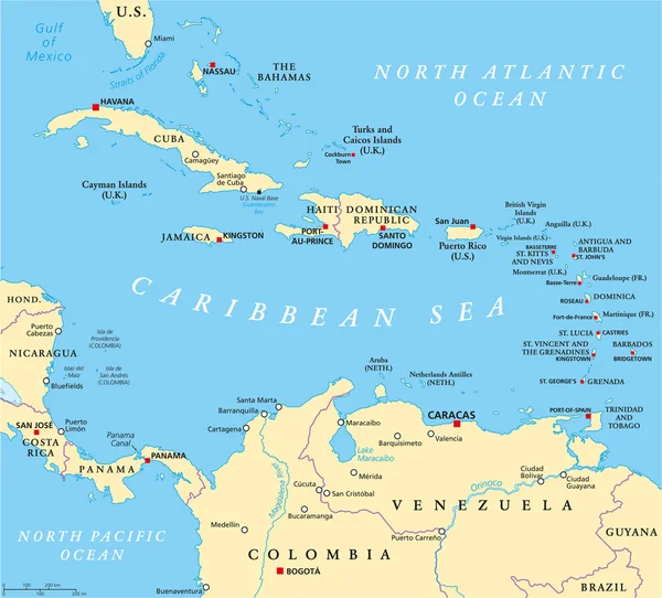
Caribbean political map with capitals, national borders, important cities, rivers and lakes. English labeling and scaling. Illustration.
Caribbean Political Map — Stock Vector
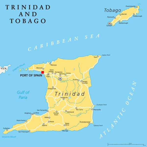
Trinidad and Tobago political map with capital Port of Spain. Twin island country in the Windward Islands and Lesser Antilles. English labeling and scaling. Illustration.
Trinidad and Tobago Political Map — Stock Vector
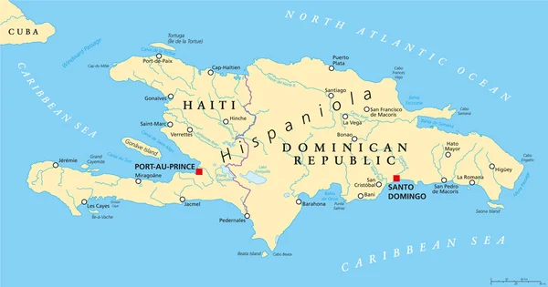
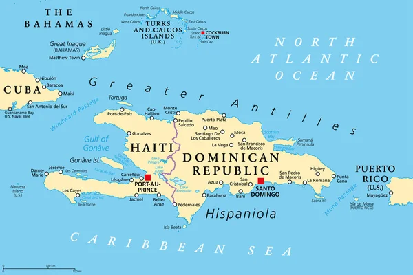
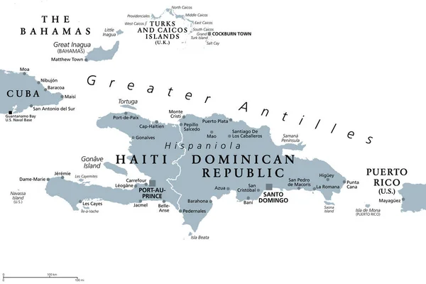
Hispaniola Political Map with Haiti and Dominican Republic, located in the Caribbean island group, the Greater Antilles. With capitals, national borders, important cities, rivers and lakes. English labeling and scaling. Illustration.
Hispaniola Political Map with Haiti and Dominican Republic — Stock Vector
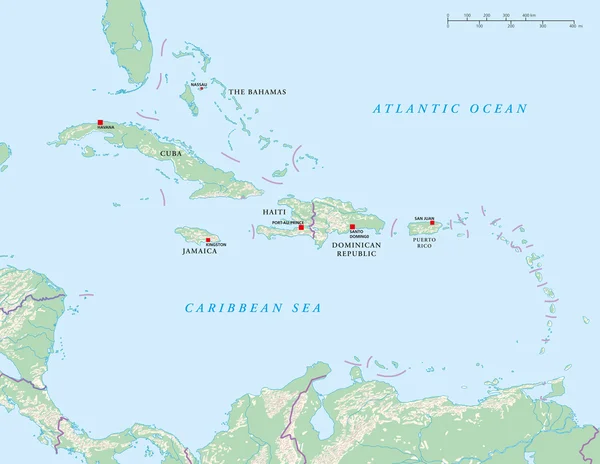
Political map of Craibbean Islands with capitals, national borders, rivers and lakes. Vector illustration with english labeling and scale.
Caribbean Islands Political Map — Stock Vector
British, Spanish and United States Virgin Islands political map. Archipelago in the Caribbean Sea. British overseas territory and unincorporated territories of the United States. Illustration. Vector.
British Spanish United States Virgin Islands Political Map Archipelago Caribbean — Stock Vector
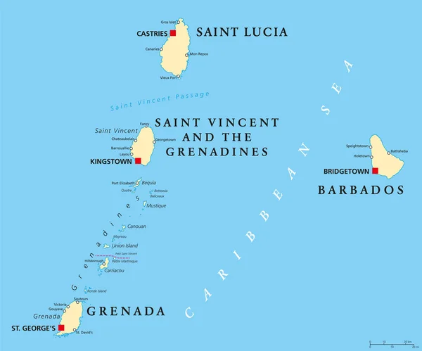
Barbados, Grenada, Saint Lucia, Saint Vincent and the Grenadines political map. Island countries in the Caribbean, part of Lesser Antilles and Windward Islands. Illustration. English labeling. Vector.
Barbados, Grenada, Saint Lucia and Saint Vincent political map — Stock Vector
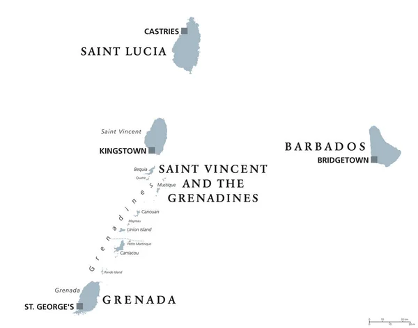
Barbados, Grenada, Saint Lucia, Saint Vincent and the Grenadines political map. Caribbean islands, part of Lesser Antilles and Windward Islands. Gray illustration over white. English labeling. Vector.
Barbados, Grenada, Saint Lucia, Saint Vincent political map — Stock Vector
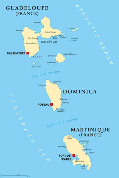
Guadeloupe, Dominica and Martinique political map with capitals Basse-Terre, Roseau and Fort-de-France. Islands in Caribbean Sea and parts of Lesser Antilles. Illustration. English labeling. Vector.
Guadeloupe, Dominica and Martinique political map — Stock Vector
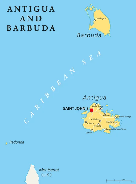
Antigua and Barbuda Political Map with capital Saint Johns and important places. English labeling and scaling. Illustration.
Antigua and Barbuda Political Map — Stock Vector
Hispaniola and surroundings, political map. Caribbean island, divided into Haiti and Dominican Republic, part of Greater Antilles, next to Cuba, The Bahamas, Puerto Rico, and Turks and Caicos Islands.
Hispaniola Surroundings Political Map Caribbean Island Divided Haiti Dominican Republic — Stock Vector
Grenada political map with capital St. Georges. Island Country and part of the Windward Islands and Lesser Antilles in the Caribbean Sea. English labeling and scaling. Illustration.
Grenada Political Map — Stock Vector
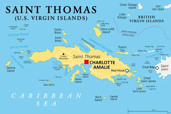
Saint Thomas, United States Virgin Islands, political map. One of the three largest islands of the USVI. The territorial capital and port of Charlotte Amalie is located on this island. Vector.
Saint Thomas United States Virgin Islands Political Map One Three — Stock Vector
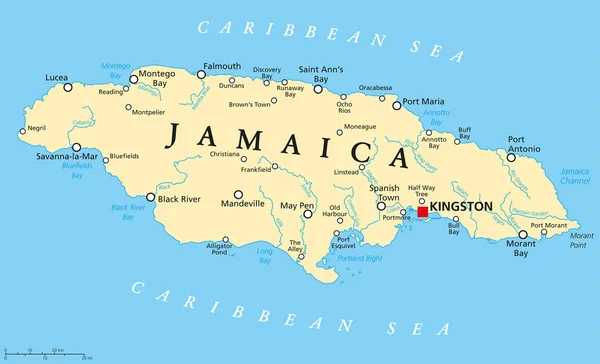
Jamaica Political Map with capital Kingston, important cities and rivers. English labeling and scaling. Illustration.
Jamaica Political Map — Stock Vector
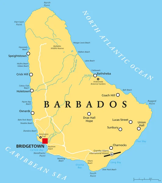
Barbados Political Map with capital Bridgetown, with important cities, places and rivers. English labeling and scaling. Illustration.
Barbados Political Map — Stock Vector
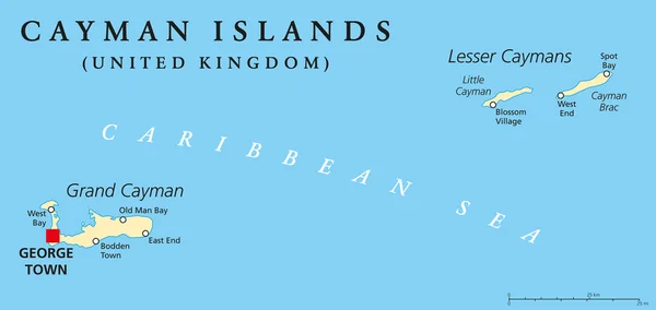
Cayman Islands Political Map with capital George Town and important places. A British Overseas Territory in the western Caribbean Sea. English labeling and scaling. Illustration.
Cayman Islands Political Map — Stock Vector
Hispaniola and surroundings, gray political map. Caribbean island divided into Haiti and Dominican Republic, part of Greater Antilles, next to Cuba, The Bahamas, Puerto Rico, Turks and Caicos Islands.
Hispaniola Surroundings Gray Political Map Caribbean Island Divided Haiti Dominican — Stock Vector

Similar Stock Videos:

Wisconsin State of USA. Animated map of USA showing the state of Wisconsin. United States of America. Neumorphism minimal style.
Wisconsin State of USA. Animated map of USA showing the state of Wisconsin. United States of America. Neumorphism minimal style — Stock Video
Minnesota State of USA. Animated map of USA showing the state of Minnesota. United States of America. Neumorphism minimal style.
Minnesota State of USA. Animated map of USA showing the state of Minnesota. United States of America. Neumorphism minimal style — Stock Video
Thank You Word Cloud in vector format.(multi language translation: Thank you)
Thank You Word Cloud Vector Format Multi Language Translation Thank — Stock Video
Soft colors of mountains and forests. Map of New York. Zoom from a world map to a map of New York. 4K FHD 60 fps animation.
Soft colors of mountains and forests. Map of New York. World map. Map of the USA. Zoom from a world map to a map of New York. Zoom from USA map to New York map. 4K FHD 60 fps animation. — Stock Video
Canada map icon isolated on background. 4K Video motion graphic animation
Canada map icon isolated on background. 4K Video motion graphic animation. — Stock Video
3D animation simulating the Ebola Virus Spreading to Europe from the African outbreak countries
Ebola Virus Spreading to Europe — Stock Video
Abstract line animation New York State of USA on hexagon style. New York state. United States of America. Outline map of New York federal state highlighted from map of USA.
Abstract line animation New York State of USA on hexagon style. New York state. United States of America. Outline map of New York federal state highlighted from map of USA — Stock Video
Abstract line animation Arizona State of USA on hexagon style. Arizona state. United States of America. Outline map of Arizona federal state highlighted from map of USA.
Abstract line animation Arizona State of USA on hexagon style. Arizona state. United States of America. Outline map of Arizona federal state highlighted from map of USA — Stock Video
World map, Island travel. Beach Tour, Flying airplane, illustration animation, vacation.
World map, Island travel. Beach Tour, Flying airplane, illustration animation, vacation. — Stock Video
World map travel. Tour, Flying airplane, illustration animation, vacation.
World map travel. Tour, Flying airplane, illustration animation, vacation. — Stock Video
Bosnia Herzegovina with flag on world map
Bosnia Herzegovina with flag on world map — Stock Video
Line animated map showing the state of California from the united state of america. Motion graphics
Line animated map showing the state of California from the united state of america. Motion graphics. — Stock Video
Abstract line animation Alaska State of USA on hexagon style. Alaska state. United States of America. Outline map of Alaska federal state highlighted from map of USA.
Abstract line animation Alaska State of USA on hexagon style. Alaska state. United States of America. Outline map of Alaska federal state highlighted from map of USA — Stock Video
Canada Map - Motion Graphic Cartoon Animation Footage. 4K Resolution Video. Transparency Alpha Channel Included. White Background
Canada Map Motion Graphic Cartoon Animation Footage Resolution Video Transparency — Stock Video
The division of Europe and Asia on the map. the city Ekaterinburg divides Europe and Asia. Eurasia on the map Animation. Eurasia. Yekaterinburg animation HD
The division of Europe and Asia on the map. the city Ekaterinburg divides Europe and Asia. Eurasia on the map Animation. Eurasia. Yekaterinburg animation — Stock Video
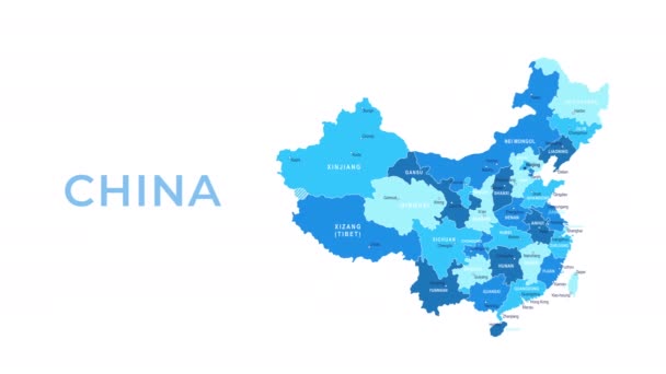
China Map - Motion Graphic Cartoon Animation Footage. 4K Resolution Video. Transparency Alpha Channel Included. White Background
China Map Motion Graphic Cartoon Animation Footage Resolution Video Transparency — Stock Video
Line animated map showing the state of South Carolina from the united state of america. Motion graphics
Line animated map showing the state of South Carolina from the united state of america. Motion graphics. — Stock Video
Germany Flag animation with moving loading
Germany Flag animation with moving loading — Stock Video

Usage Information

You can use this royalty-free vector image "Windward Islands political map. Islands of the Lesser Antilles, south of the Leeward Islands in the Caribbean Sea. From Dominica, Martinique, Saint Lucia, Saint Vincent and the Grenadines, to Grenada." for personal and commercial purposes according to the Standard or Extended License. The Standard License covers most use cases, including advertising, UI designs, and product packaging, and allows up to 500,000 print copies. The Extended License permits all use cases under the Standard License with unlimited print rights and allows you to use the downloaded vector files for merchandise, product resale, or free distribution.

This stock vector image is scalable to any size. You can buy and download it in high resolution up to 6000x9000. Upload Date: Apr 5, 2022