Bombay Harbour (Front Bay)
India /
Maharashtra /
Mumbai /
World
/ India
/ Maharashtra
/ Mumbai
World / India / Maharashtra / Greater Bombay
water, bay, invisible, harbour

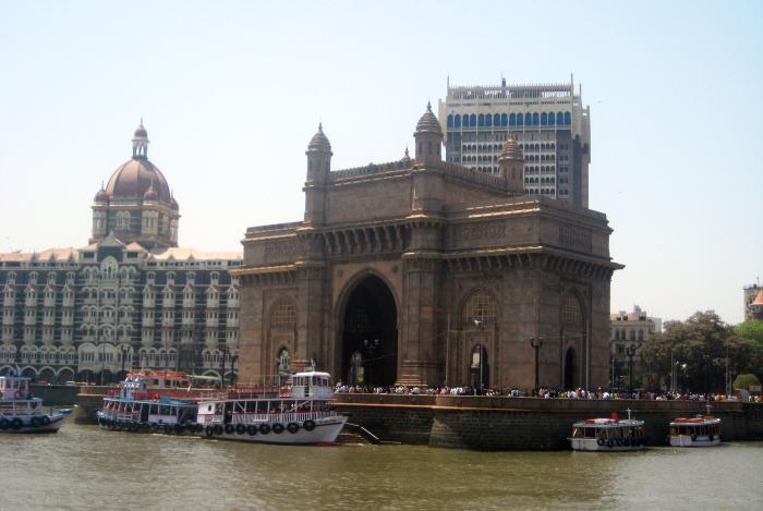


Front Bay (in contrast to BackBay which is on the other side), also called Bombay Harbor. The water body which gave the city its name. The Portuguese, after driving the Arab forces out, named the large anchorage or sea-roads off the eastern end of the former Bombay Island as Bom Bahia or Good Bay, and this name was then applied to the island also. This name was then anglicized to Bombay.
Wikipedia article: http://en.wikipedia.org/wiki/Front_Bay
Nearby cities:
Coordinates: 18°55'8"N 72°50'5"E
- Gulf of Khambhat 381 km
- Gulf of Kutch 654 km
- Gulf of Mannar, Tamil Nadu 1215 km
- Gulf of Masirah 1598 km
- Khalij Khuria Muriya 1862 km
- Gulf of Oman 1926 km
- Gulf of Salwa 2417 km
- Khur-e Musa Bay (Musa Bay) 2738 km
- Persian Gulf 2799 km
- Turkmenbashi Bay 3019 km
- The Taj Mahal Palace Hotel 0.4 km
- Apollo Bunder 0.4 km
- Electric House Bus Station / Colaba Bus Depot / BEST HeadQuarters 0.6 km
- Maharashtra State Police Head Offices & former State Legislative Assembly buildings 0.7 km
- Cusrow Baug 0.7 km
- Chhatrapati Shivaji Maharaj Museum Complex (Prince of Wales Museum) 0.9 km
- Cooperage Grounds, Colaba 0.9 km
- Naval Dockyard / Bombay Dockyard 1.1 km
- Oval Maidan 1.3 km
- Fort 1.6 km
The Taj Mahal Palace Hotel
Apollo Bunder
Electric House Bus Station / Colaba Bus Depot / BEST HeadQuarters
Maharashtra State Police Head Offices & former State Legislative Assembly buildings
Cusrow Baug
Chhatrapati Shivaji Maharaj Museum Complex (Prince of Wales Museum)
Cooperage Grounds, Colaba
Naval Dockyard / Bombay Dockyard
Oval Maidan
Fort
Comments