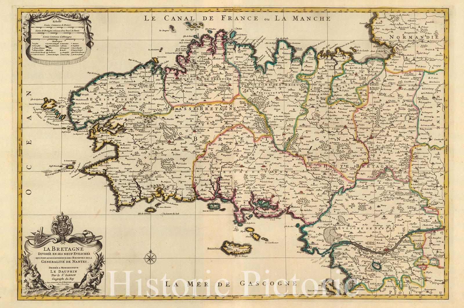
Le Bretagne. | Atlas Nouveau Contenant Toutes Les Parties du Monde, ou Sont exactement Remarques Les Empires, Monarchies, Royaumes, Estats, Republiques & Peuples qui fy trouuent a present. Par le Sr. Sanson, Geographe ordinaire du Roy. Presente a Monseigeur le Dauphin ... Hubert Jaillot Geographe du Roy. A Paris, Chez Hubert Jaillot .... | This issue of the Mortier/Jaillot Atlas Nouveau has 169 maps (1 more than the normal count of 168) plus diagrams, text pages, decorated titles and index pages. It is noted for the large number of multi-sheet "Theatre de la Guerre" (Theater of War) maps covering the battles raging in Europe and the Americas during the Spanish War of Succession (1701-1713) and the Northern War (1700-1721). The Atlas Nouveaux was first published by Jaillot in Paris in 1681(46 maps) with later issues by him in 1684 (72 maps) and 1689 (80 maps). In 1692 Pierre Mortier published his first edition of the Jaillot atlas with 99 maps, another edition followed in 1696 with 111 maps. In 1707/1708 Mortier issued our edition with 168 maps. Later editions by Mortier expanded the atlas even further - 1708, 200 maps; ca 1721, 300 maps; ca 1735, 400 maps. The atlas maps are large folio size with most maps made of two sheets and many maps combining 4 or 6 sheets (those also issued as wall maps separately). The atlas is most impressive for its large size and number of maps as well as being up to date for its time. This copy colored in outline with relief shown pictorially.
We print high quality reproductions of historical maps, photographs, prints, etc. Because of their historical nature, some of these images may show signs of wear and tear - small rips, stains, creases, etc. We believe that in many cases this contributes to the historical character of the item.


