New images showing how the atomic bomb tests at Bikini Atoll altered the landscape beneath have been revealed by scientists. The maps show shipwrecks and craters from the bombs, providing "new insights into the forces that shaped the seabed from the blast."
Tests took place at the atoll, a coral reef in the Marshall Islands, between 1946 and 1954. During this time, 23 nuclear weapons were detonated by the U.S. Dozens of ships were sunk during the test period, including battleships, submarines, aircraft carriers and destroyers.
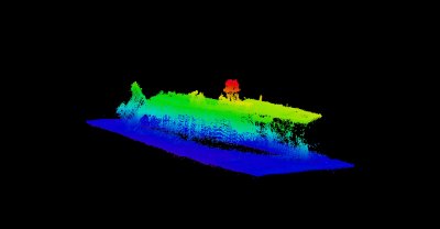
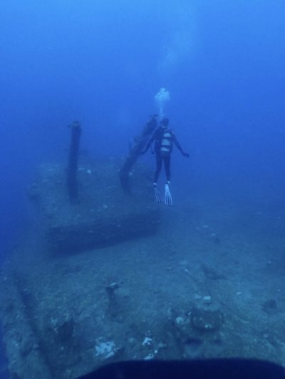
Earlier this year, Arthur Trembanis, from the University of Delaware, led a project to map the seafloor of Bikini Lagoon and its 12 shipwrecks, including one the size of the Titanic. Using historical data collected by the U.S. Navy and Department of Energy, the team used sonar and other modern techniques to create up-to-date detailed maps of the seafloor and the wrecks resting there.
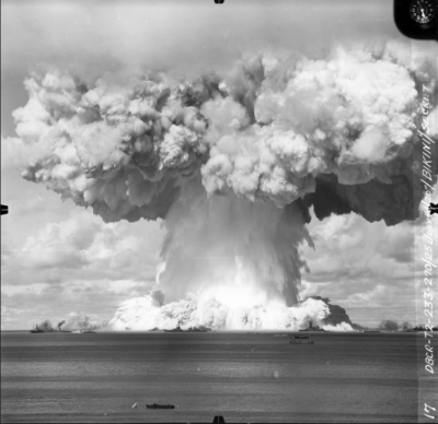
They produced 3D scans of the seafloor and developed outlines of the shipwrecks and debris at the bottom of the lagoon. The site mapped was where tests took place during Operation Crossroads, which was where two nuclear weapons were detonated. One of the bombs, named Able, was dropped from a plane and exploded above the water, while the other, named Baker, was detonated 90 feet below the surface of the water.
"In short order, the team produced a detailed, three-dimensional map of the simulated nuclear battlefield, with every ship accurately pinpointed," James Delgado, now senior vice president of SEARCH, a cultural resource management firm in charge of the project, said in a statement.
"This is the largest undersea battlefield surveyed and mapped, and it is a game changer in assessing major events that have left a profound footprint on the seafloor. What Art and the team have done is given the world its first-ever look beneath the sea into the heart of an atomic explosion and its aftermath."
Trembanis has now presented their findings at the American Geophysical Union meeting in San Francisco.

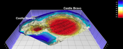
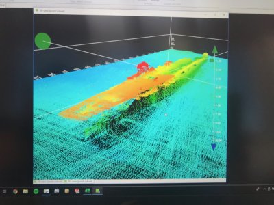
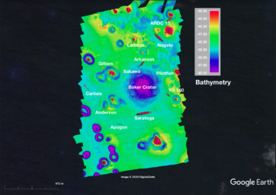
Findings showed the crater left by the underwater bomb Baker was still prominent and had not been filled with sediment. "It seems as if Captain Marvel herself has punched the planet and put a dent into it," the BBC quotes Trembanis as saying.
In its presentation, the team said there are features of the seabed that "radiate away from the impact crater." It is thought these newly discovered features were produced by waves generated by the blast. "These detailed geomorphic measurements provide a signature for what the first water born test of an atomic weapon look like," their research abstract said.
A Japanese cruiser sunk by the airborne bomb Able, the team discovered, had been blasted deep into the seabed so far down they had initially missed it.
The team hopes to return to the site to continue investigating the impact of the bombs. "When people think of that photo with the mushroom cloud, that's where we were. You see how dwarfed these massive ships were by that blast," Trembanis said in a statement. "In many ways, I was struck by it being this idyllic, beautiful Pacific island and I thought 'This was the site of the most violent explosions on the planet.' It's still very much a puzzle, and we'd love to be able to go back."
Tim Henstock, Professor of Geophysics within Ocean and Earth Science at the U.K.'s University of Southampton, who was not involved in the study, said the research shows the capabilities of modern sonar systems.
"The striking images—mapping the water depths across Bikini Atoll with pixels as little as one meter in size—show a seabed that is the product of a combination of natural and human-generated processes," he told Newsweek. "The new data are sufficiently detailed to show details of sediments moved by waves caused by the blast, as well as allowing the state of the wrecks to be assessed.
"This type of survey is becoming more common, both to investigate the health of natural systems and how human infrastructure and natural systems interact. Repeated sonar surveys can be used to monitor how structures such as offshore wind turbines locally modify the movement of sediments—important both to ensure their long-term operation and stability, and to determine how they are affecting the seabed around them."
This article has been updated to include quotes from Tim Henstock.
Correction 12/12, 10.21 a.m. The spelling of Trembanis has been corrected throughout this article.
Uncommon Knowledge
Newsweek is committed to challenging conventional wisdom and finding connections in the search for common ground.
Newsweek is committed to challenging conventional wisdom and finding connections in the search for common ground.
About the writer
Hannah Osborne is Nesweek's Science Editor, based in London, UK. Hannah joined Newsweek in 2017 from IBTimes UK. She is ... Read more


