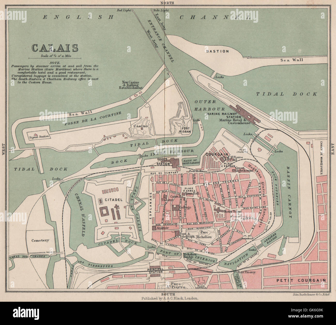
CALAIS antique town city plan de la ville. Harbour port. Pas-de-Calais 1913 map
RFID:Image ID:GK6G9K
Image details
Contributor:
Antiqua Print Gallery / Alamy Stock PhotoImage ID:
GK6G9KFile size:
11.5 MB (793.5 KB Compressed download)Releases:
Model - no | Property - noDo I need a release?Dimensions:
2112 x 1896 px | 35.8 x 32.1 cm | 14.1 x 12.6 inches | 150dpiDate taken:
1913Location:
Pas-de-CalaisMore information:
This image could have imperfections as it’s either historical or reportage.
'Calais '. Artist/engraver/cartographer: John Bartholomew & Co, Edinr. Provenance: "Black's Guide to Normandy Picardy, Artois, Ponthieu and parts of the Ile de France"; by C.B. Black, published by Adam and Charles Black, London. 9th edition. Type: Antique colour travel map.